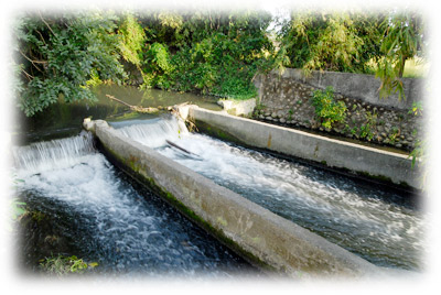
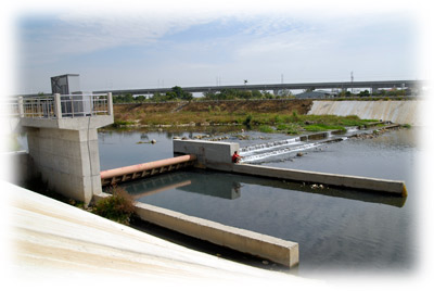
The jurisdiction of the office is located in western Taiwan, bounded by the Dadu Mountain Platform and divided into two irrigation areas. One is the Taichung Basin between the eastern foot of the Dadu Mountain Platform and the Central Mountains; the other is the Dadu Mountain area including the coastal plains such as Dadu, Qingshui, Dajia, and Yuanli between the western foot of the platform and the western coast.
The geographical characteristics of irrigated areas are as follows:
The water source comes from three major water systems: Daan River, Dajia River and Wu River. The Wu River water system provides water to Taipingyi Canal and Datuliao Canal, and its tributary Toubiankeng River provides water to Toubiankeng Canal and Zhancuoyuan Canal. Its tributary Hanxi provides water to Liangshashu Lateral Canal, Wuzhangli Canal, Liangyi Lateral Canal and Axili Canal; its tributary Faizi River provides water to Zhigao Canal and Wangtian Canal, and the final section of Wu River water system is called Dadu River, from where Dadu Workstation diverts water. As the riverbed of Dadu River in this section is lower than Dadu Canal, the office set up a Dadu Canal Pumping Station at Dadu Workstation to divert water from Dadu River for irrigation.
The Dajia River system supplies water to several irrigation canals, including Baileng Canal, Dongshi Main Canal, Damaopu Canal, Lao Canal, Shiweiqiang Canal, Babao Canal, Huludun Canal system, Neipu Canal, Huyan Canal No. 1, Huyan Canal No. 2, Wufu Canal, and Gaomei Canal. However, in recent years, the continuous deepening of the Dajia River bed has made it difficult for these canals to draw water. Currently, Neipu and Huyan No. 1 canals have installed pumping stations to supplement agricultural irrigation.
The Da’an River system provides water to irrigation canals such as Zhuolan Canal, Shibikeng Canal, Puwei Heng Canal, Aishan Canal, Houli Canal System, Koutan Canal, Xindian Canal, Liyutan Canal, Yuanli Canal, Rinan Canal, and Jiuzhangli Canal. However, in recent years, the continuous deepening of the Da'an River bed has caused difficulties in water intake for these canals. Currently, Koutan Canal has added a pumping station to assist with agricultural irrigation.
With the changes in the river bed, the task of this association to draw water from rivers for farmland irrigation has become increasingly difficult. The construction of water intake projects requires more and more funding, and the electricity costs for the pumping stations are a significant financial burden for our office.
There are four types of geology within the jurisdiction. Yuanli Township, Miaoli County, Houli District, Xinshe District and Dadu District in Taichung City belong to the laterite layer, Dajia District and Qingshui District has sandy gray soil, and the rest of the area is loam and sandy loam.
The jurisdiction of the office covers all Greater Taichung City and the townships of Yuanli, Tongxiao, Zhuolan, and Sanyi in Miaoli County, with an irrigation area of 26,007 hectares.
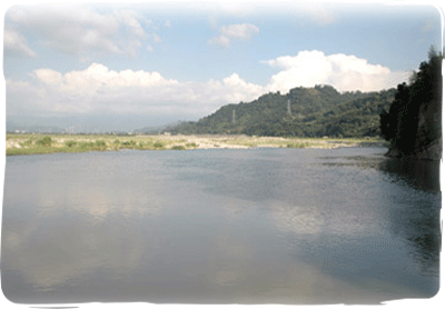
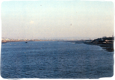
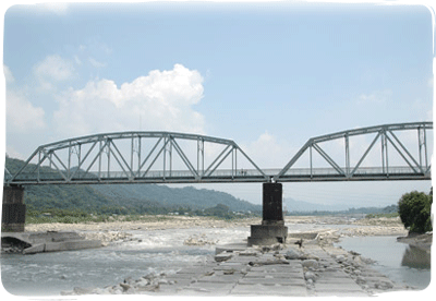
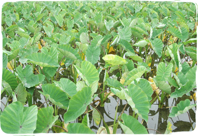
The irrigation pattern within our jurisdiction employs a river-fed irrigation system, primarily sourcing water from the Da’an, Dajia, and Wu Rivers. The total irrigated area is approximately 25,579 hectares, with rice paddies covering about 21,313 hectares, accounting for 82% of the total area. The rice cultivation areas for each river system are as follows: Da'an River: 8,990 hectares, Dajia River: 9,538 hectares, and Wu River: 2,785 hectares. (First crop of 2024)
Dry crop pipeline irrigation facilities allow for timely and appropriate irrigation, conserving water, reducing labor costs, ensuring more uniform irrigation, improving crop quality and yield, and increasing farmers' income. Since 1986, we have been promoting dryland crop irrigation projects. To date, the area utilizing this method is about 4,016 hectares, benefiting 8,025 households. The project covers areas including Zhuolan Township and Dahu Township in Miaoli County, as well as Fengyuan District, Dongshi District, Xinshe District, Houli District, Shigang District, Waipu District, Taiping District, and Heping District in Taichung City. Most crops grown are fruits (grapes, pears, carambolas, citrus, sweet persimmons, etc.) and flowers (orchids, etc.)
We have established a central monitoring station with 23 sub-stations, totaling 251 monitoring points. Tests are conducted every two months. If water quality fails to meet standards, temporary monitoring points are added, or the monitoring frequency is increased to ensure the quality of irrigation water. Annual inspections of non-agricultural drainage water quality are conducted, and households with abnormal or non-compliant discharges are required to make improvements within a specified period. These households are continuously monitored until the improvements are completed, at which point they are cleared from the monitoring list.
In addition to intensified patrols of irrigation channels by workstations, we employ 225 sluice gate keepers to oversee 340 locations, assisting with drainage management. This approach has proven highly effective in preventing disasters from typhoons and heavy rains.
An annual joint meeting for group leaders is held to communicate current office initiatives and gather feedback on grassroots operations to improve service quality.
Workstation personnel are responsible for the maintenance, inspection, and repair of irrigation channels.
Up to 2024, we have established 32 real-time water flow monitoring stations in the Dajia River and Da'an River systems. These stations, located at workstations and intake points, allow for 24-hour online monitoring of rainfall and intake flow data, facilitating the management and allocation of irrigation water.
The Da'an River originates from the western slopes of Mount Dabajian (3,505m) in the Xueshan Mountain Range, with its highest elevation reaching 3,396 meters. The upper reaches consist of mountain streams such as Xueshankeng and Wushikeng. The main stream, after converging with the Madala and Cigao rivers, flows southwest to Shuangqi, where the riverbed gradually broadens into a floodplain, forming a braided channel before turning slightly northwest. After flowing through the Zhuolan alluvial fan, the river narrows as it passes through the hills at Qikuaicuo (near Tai'an Station on the mountain railway line), where the riverbed expands again. The right bank incorporates the Jingshan River (Duoluo River) near Liyutan and continues northwest, creating a broad alluvial plain between Huoyanshan and the Houli Terrace. This area features significant meandering and forms a typical canyon landscape. The right bank includes the Madala, Beikeng, Laozhuang, and Jingshan rivers, while the left bank has the Cigao, Daxue, Nankeng, and Wuming rivers, ultimately flowing into the sea at Da'an Township. The catchment area is 765 square kilometers, and the river length is 96 kilometers.
The Da'an River basin is bordered by the Touqian River and Houlong River to the north, and the Dajia River to the south, extending east to the Xueshan Range watershed and west to the Taiwan Strait. It spans Miaoli County and Taichung City. In Miaoli County, it covers the townships of Taian, Zhuolan, Dahu, Sanyi, and Yuanli. In Taichung City, it includes the districts of Heping, Dongshi, Houli, Waipu, Dajia, and Da'an. The basin is elongated east-west and narrow north-south, resembling an eggplant shape, with an average gradient of 1:63—1:21 in the upper reaches, 1:55 in the middle, and 1:90 in the lower. Its short length and steep gradient make it one of Taiwan's rapid-flowing rivers.
There are 11 irrigation channels drawing water from the Da'an River, irrigating an area of 10,616 hectares. Due to the river's high source, short course, and steep gradients, the period from October to May before the arrival of the plum rain season is considered the dry season. The first crop's spring plowing and rice transplanting period is particularly water-scarce. Rainfall during the dry season accounts for only about 2% of the annual precipitation, with rainfall often less than 30 mm and sometimes no rain for two to three consecutive months. Currently, the Da'an River lacks water storage facilities such as reservoirs or regulating ponds, making it a water-scarce area. Every year during the first crop's spring irrigation period, a temporary Da'an River water distribution and regulation team must be organized to strengthen water allocation and ensure the completion of irrigation tasks.
The Dajia River originates from Xueshan and Mount Nanhu in the Central Mountain Range, with Xueshan at an elevation of 3,884 meters and Mount Nanhu at 3,740 meters. The upstream watershed and peaks of the Dajia River are mostly above 3,000 meters. The basin expands as various streams converge at Taibaojiu to form the main stream of the Dajia River. It flows through the broad river valley of Lishan and Jiayang, reaching Dajian. Below Dajian, the river takes on a belt-like shape, flowing through Guguan, Baileng, Maanliao, and Dongshi into the plain, then meandering westward through Shigang and finally emptying into the Taiwan Strait north of Wuqi. The basin covers an area of 1,236 square kilometers, with an average gradient of 1:60 (1:36 in the upper reaches and 1:90 in the lower reaches), making it one of Taiwan's fast-flowing rivers, stretching 140.21 kilometers in length.
The Dajia River is bordered by the Da'an River to the north, the Tamsui River and Lanyang River to the northeast, and the Central Mountain Range watershed to the east, adjacent to the Liwu River of Taiwan's eastern river system. It is connected to the Wu River in the south and the Taiwan Strait to the west. The river flows through 11 administrative districts in Taichung City, including Heping, Dongshi, Xinshe, Shigang, Fengyuan, Houli, Shengang, Waipu, Dajia, Daan, and Qingshui. There are 15 irrigation channels drawing water from the Dajia River, irrigating an area of 12,244 hectares.
The Dajia River system boasts the richest hydroelectric resources in Taiwan, making it the most suitable river for hydropower generation. This is why the Dajia River Basin Development Plan was implemented early on, taking advantage of its excellent conditions. From upstream to downstream, several infrastructures along the river have been completed, including the Techi Reservoir, Techi Power Plant, Qingshan Dam and Qingshan Power Plant, Guguan Dam and Guguan Power Plant, Tianlun Dam, Tianlun Power Plant, Tianlun Afterbay Weir, as well as the Shigang Dam. These reservoirs and regulating ponds have enhanced the river's ability to generate electricity while also improving water supply stability for downstream public use and agriculture by regulating water storage and release.
The Wu River originates from the western slopes of Hehuanshan in the Central Mountain Range. It meanders through the valleys for a total length of 117 kilometers, with a basin area of 2,035 square kilometers, covering 27.5% of four regions including Nantou County, Taichung City, and Changhua County, making it Taiwan's fourth-largest river. Based on its characteristics, it is classified as a lowland river, similar to the Tamsui River, Lanyang River, Zhuoshui River, and Gaoping River.
The river has numerous tributaries, with the main water systems divided into:
- The main stream of Wu River and the upstream Beigang River system
- The Nangang River system
- The Maoluo River system
- The Dali River system
- The Fazih River system
The latter two tributary systems fall within our irrigation district.
The Wu River is bordered by the Dajia River to the north and is surrounded by the Zhuoshui River to the southeast, with the Taiwan Strait to the west. It stretches approximately 84 kilometers east to south and 52 kilometers north to south, resembling the shape of a tung leaf. It flows through eight townships in Nantou County: Ren'ai, Guoxing, Yuchi, Puli, Caotun, Mingjian, Zhongliao, and Nantou City. In Taichung City, it passes through the districts of Heping, Fengyuan, Tanzi, Shengang, Daya, Shalu, Taiping, Dali, Wufeng, Wuri, and Dadu. In Changhua County, it includes all of Shengang Township. Within our jurisdiction, there are 12 irrigation channels drawing water from the Wu River, irrigating an area of 3,147 hectares. Among these, the Dadu Canal, located at the furthest downstream point, uses electric pumps to draw water from the Wu River, making irrigation less convenient. The other canals typically have abundant water sources, primarily supporting double cropping of rice.
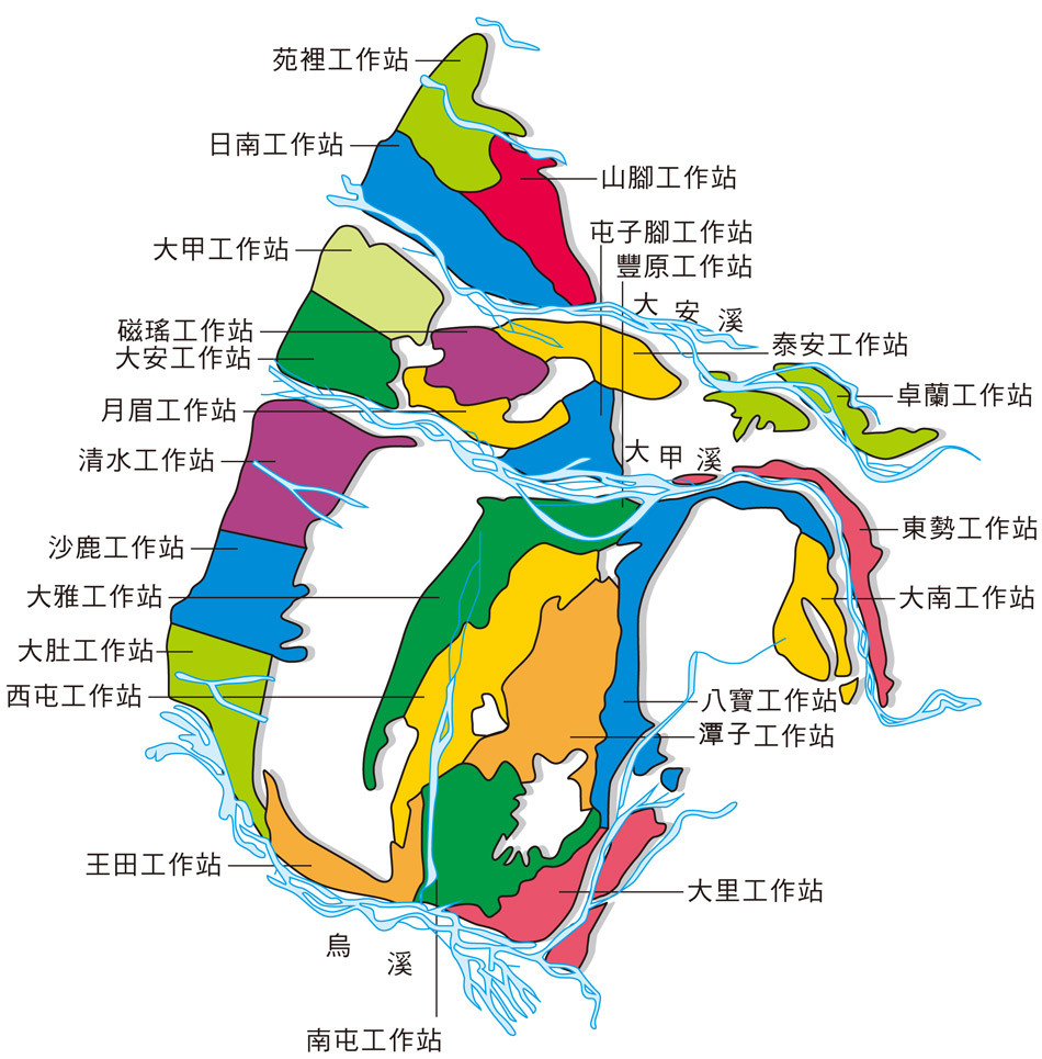
The workstations in the irrigation jurisdiction areas from north to south are as follows:
Yuanli Station, Rinan Station, Shanjiau Station, Dajia Station, Da'an Station, Ciyao Station, Tai'an Station, Zhuolan Station, Yuemei Station, Tuntzuchiao Station, Qingshui Station, Fengyuan Station, Shalu Station, Daya Station, Danan Station, Dadu Station, Xitun Station, Tanzi Station, Babau Station, Wangtian Station, Nantun Station, Dali Station
Taiwan, located in the subtropical region, has a warm, rainy climate with ample sunshine, making it well-suited for agriculture. However, due to uneven rainfall distribution, short and rapid rivers, and fragile geology, the island frequently faces floods and droughts. Early settlers overcame these challenges by building dikes and canals to engage in irrigation farming, laying the foundation for today's prosperity. Irrigation is an ancient art intertwined with agriculture and a modern survival science. Paddy field irrigation is a testament to the wisdom of our ancestors. Taiwan's irrigation industry is highly developed and has always been prioritized by the government, with its management and effectiveness renowned worldwide. Since 1976, the government has implemented various plans to update and improve irrigation and drainage facilities, including plans for accelerating rural construction, improving agricultural structure, enhancing irrigation associations, comprehensive agricultural adjustments, and providing subsidies to reduce irrigation associations' fees. These efforts have yielded significant results. Currently, the total irrigated area in Taiwan is approximately 500,000 hectares, with 380,000 hectares under the jurisdiction of local irrigation associations. To ensure the functionality of agricultural irrigation, it is necessary to continually update and improve water intake facilities, water conveyance channels, and structures as planned.
With rapid economic development and intensive land use, facilities initially designed for agricultural drainage now serve multiple purposes as regional drainage systems. Early drainage systems were designed primarily for agricultural land, thus allowing for a certain degree of waterlogging. However, due to rapid industrial and commercial growth in recent years, higher standards are required to protect lives and property and mitigate flooding from typhoons and heavy rains. Since 1973, the government has been committed to improving drainage and has achieved notable success. However, due to adverse terrain, geology, and natural conditions, drainage channels are prone to siltation. Furthermore, county and city governments face budget and manpower constraints in maintenance and management. The extensive development of land for non-agricultural uses and urbanization has significantly reduced the land's water retention capacity. This has led to increased runoff and higher flood volumes, making existing drainage channels insufficient to meet the drainage needs. As a result, low-lying areas are still prone to flooding during typhoons and heavy rains.
Since 1998, the central government has continuously been requested to allocate funds to assist local authorities in improving and maintaining regional drainage systems in a bid to protect lives and property while supporting the country's overall development.
Currently, Taiwan's irrigated area is approximately 380,000 hectares, managed and operated by 15 irrigation associations across the island. The majority of irrigation water is sourced from river runoff, reservoirs, or groundwater. This water is then transported through a network of channels, including connecting channels, main channels, lateral channels, sub-later channels, and field ditches, to nourish crops, enabling vigorous growth, flowering, and fruiting.
Irrigation water from rivers, reservoirs, or groundwater is conveyed through a complex system of channels. This network includes connecting channels, main channels, lateral channels, sub-lateral channels, distributaries, and field ditches, totaling an impressive 44,533 km across Taiwan's irrigation districts. These waterways are supplemented by numerous associated structures.
Although Taiwan's water conservancy is well-developed, some areas still face water shortages or are limited by topography, making it challenging to supply adequate water for crop irrigation. This results in low crop yields, economic struggles in agriculture, and rural decline. To enhance agricultural productivity and effectiveness, detailed planning has been undertaken to improve water conveyance facilities. Additionally, the adoption of water-saving sprinkler irrigation methods has led to increased agricultural production, higher farmer incomes, and a thriving rural economy.
Water is the source of life for all living things; without it, nothing can grow. During the dry season in February and March, some water-scarce areas face urgent agricultural water needs. To address this, our office seeks to effectively allocate and use the remaining agricultural water to irrigate fields in need, ensuring crops receive a timely water supply, which supports balanced rural development.
